Did you know the UK has one of the biggest and best selections of hiking trails in the world?
This small area of land is so jam packed with hiking routes it means you’re never far from an outdoor experience. From 120 mile behemoth adventures through mountain ranges, historical strolls along coastal cliffs or even just a scenic route to discover a new destination, the UK really has hiking options to wow everyone.
To make things even better trails are well marked, accommodation and transport options are bountiful and, most importantly, you’re never far from a good pub!
We’ve put together this collection of the very best hikes in the UK with options to exhilarate every level of hiker. The question is, how many can you fit into your trip?
18 of the Very Best Hikes in the UK You Need to Explore This Year
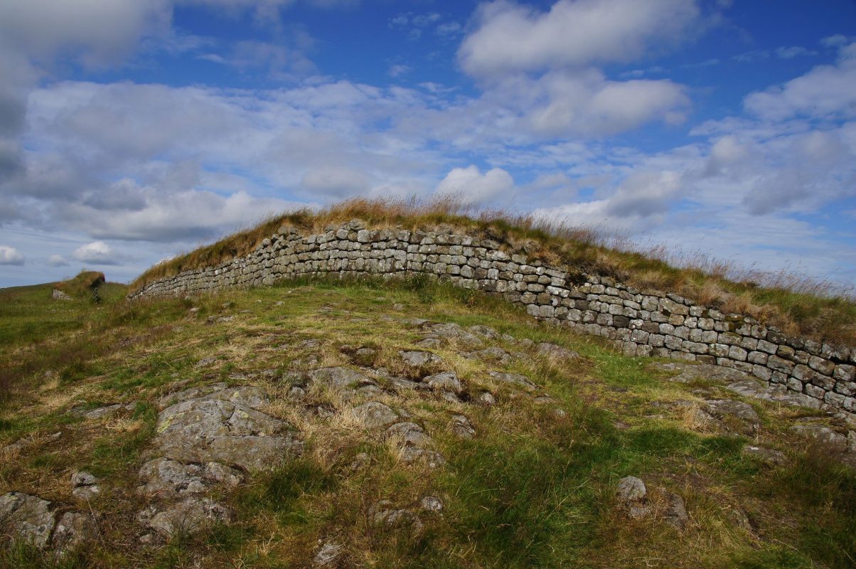
Hadrian’s Wall
Where: Coast to coast in Northern England (roughly Carlisle to Newcastle)
Distance: 73 miles
Time needed: 6 – 7 days but can be broken down into sections
A walk across England alongside Hadrian’s Wall is the perfect way to enjoy the English countryside, see the most famous Roman site in Britain, and learn about the country’s history at the same time.
It’s a common misconception that this ancient Roman wall, built during the reign of the Emperor Hadrian, marks the boundary between England and Scotland. In reality, the wall lies entirely within England, although at its western end it’s only about half a mile south of the Scottish border.
Walking the entire length of the wall takes about six days, but if you don’t have that much time you can simply walk a section of it, and perhaps use the convenient AD122 hop-on-hop-off bus to skip around to a few of the most famous sights along the wall.
I recommend basing yourself in the small city of Hexham, which is near the most famous stretch of the wall. From here, you can visit Chester’s Fort and Housesteads Fort, as well as some of the milecastles that punctuate the wall at every mile. Well, every Roman mile, that is.
My top pick of the milecastles is Milecastle 42. While only the foundations remain today, you can climb up a nearby ridge to get a bird’s eye view of what’s left, and then stop in at the Milecastle Inn for some pub grub to fuel the rest of your hike.
The owners of this traditional English pub are very friendly and will happily cater for vegan hikers of Hadrian’s Wall with advance notice. They even surprised us with strawberries and non-dairy cream for dessert!
Hadrian’s Wall is one of the bests hikes in the UK and can be done at any time of year, but summer is your best chance of having good weather.
Recommended by Wendy from The Nomadic Vegan
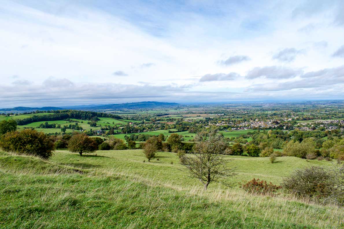
The Cotswolds Way
Where: South West England
Distance: 100 miles
Time needed: 7 – 9 days but can be broken down into sections
The Cotswolds is one of the UK’s most beautiful areas and is home to one of the most stunning hikes in the UK. The countryside is full of gently rolling hills, dotted with sheep, and with quaint honey coloured villages scattered throughout.
The Cotswolds Way is a public trail just over 100 miles long. The trail takes you from the gorgeous Chipping Campden in the north of the region down to the UNESCO listed city of Bath in the south. The main part of the trail is set along the spine of the Cotswolds, so you get great views while you’re walking.
Walking the entire length of the Cotswolds Way will take you some time. It’s fairly easy walking in itself so you don’t need any specialist equipment other than good shoes and the usual provisions. However the paths are not always obvious and in some places the signage could be better so it would be a good idea to bring along GPS to make sure you don’t get lost. You will also need to book accommodation along the trail well in advance.
If you don’t want to walk the whole Cotswolds Way then I’d recommend the area around Chipping Campden and Broadway as one of the best places to explore. Broadway Tower is a 3 storey folly perched on the second highest hill in the area, so you can get amazing views across the Cotswolds from here. The towns of Broadway and Chipping Campden are also two of the most picturesque towns in the area.
Recommended by Emily from Kids and Compass
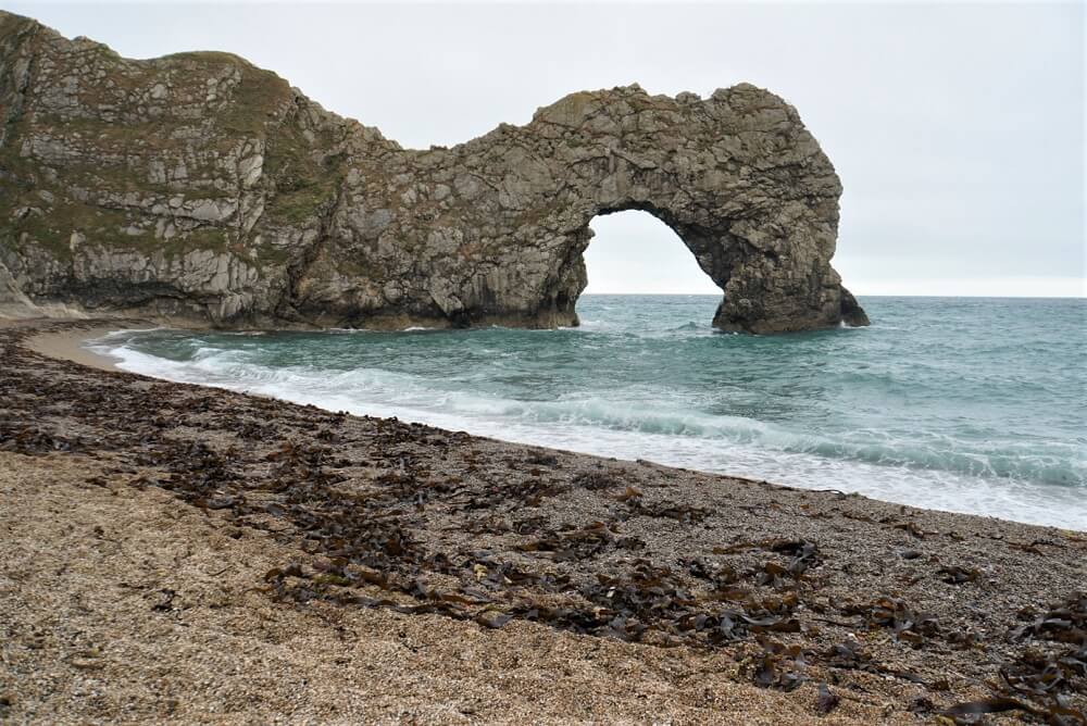
Lulworth Cove to Durdle Door Hike
Where: Jurassic Coast, Dorset
Distance: 2.5 miles return
Time needed: 1 hour (2 with pictures!)
In England, you will find the 630-mile-long South West Coast Path. I think the section along the Jurassic Coast in Dorset from Lulworth Cove to the Durdle Door is one of the best hikes in the UK. The coastline is stunning but the highlight is the Durdle Door rock formation in the English Channel. You also pass by Man O War Beach which looks more like a beach you’d expect to see in Hawaii than in England!
The hike from Lulworth Cove to Durdle Door is about 1.25 miles one way or 2.5 miles round trip. It’s not a difficult hike but the views are out of this world. I would recommend allowing two hours to do the hike because you’ll want to take a lot of pictures. It’s also worth going down the stairs to the Durdle Door Beach and get a different perspective.
The weather may be best for hiking during the summer but you will need to be prepared for the crowds. I recommend going in the spring or fall for a more peaceful experience.
Public Transportation is limited in the area so it’s best to drive to the Lulworth Cove car park to start your hike. Use postcode BH20 5RQ in your GPS. If you are looking for accommodation in the area the Durdle Door Holiday Park has options in a few different price ranges.
Recommended by Anisa from Two Traveling Texans
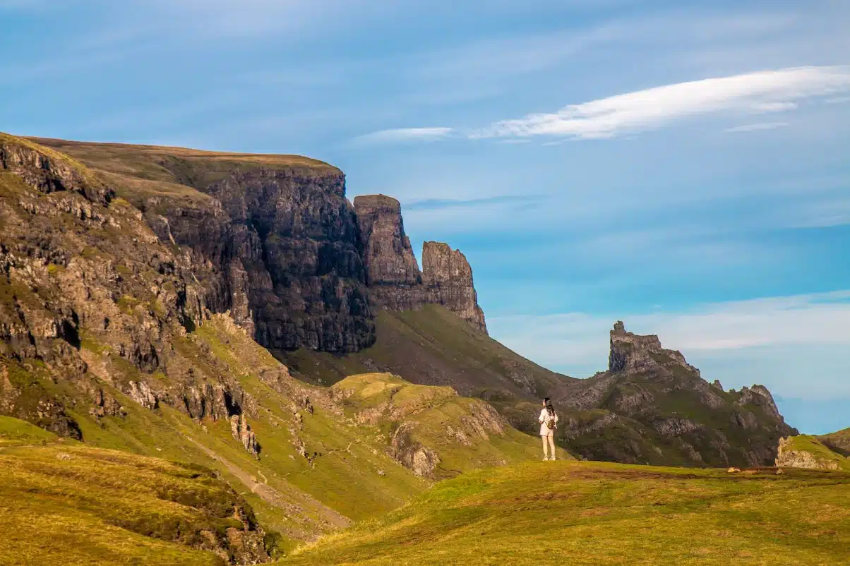
The Quirang
Where: Isle of Skye, Scotland
Distance: 4 miles
Time needed: 2 / 3 hours
Hiking the Quirang isn’t one of the most popular things to do on the Isle of Skye in Scotland, but that’s precisely what makes it one of the best.
The Quirang is located on the island’s northern Trotternish Peninsula, which can become crowded with cars and tourist buses in the peak summer season. But once you get on the trail in the villages of Staffin or Uig (which are connected by a single track road), you’ll find far fewer people jockeying to find the best selfie spot.
The trail, which about takes two to three hours to trek depending on how often you stop, is ideal for landscape photographers. The area is packed with stunning geological features known as the Needle (a jagged 120-foot tall pinnacle), the Table (a flat, grassy area that slipped down from the 1,781-foot summit), and the Prison (a pyramid-shaped peak that looks like a medieval keep from certain angles).
The 6.8 km hike can be somewhat difficult due to the steep slopes and uneven landscapes (see: lots of rocks underfoot). You definitely won’t want to go when it’s wet due to visibility and slippage, and beware of high wind gusts at the summit. But the scenery is among the most stunning in Scotland, with picturesque Staffin Bay as the backdrop. To top it off, wild camping on Skye is incredible and an opportunity which shouldn’t be passed up!
Recommended by Bret & Mary from Green Global Travel

The West Mendip Way
Where: Somerset, South-West England
Distance: 30 miles
Time Needed: 2 / 3 days but can be broken down into sections
The West Mendip Way runs from the Bristol Channel at Uphill on the outskirts of Weston-Super-Mare following the hills past the well named Crook Peak (it really does have a crooked peak) and Wavering Down towards Cheddar Gorge. Eventually it reaches the smallest city in England at Wells. This hiking trail can be broken into three or four sections for easy day walks while basing yourself in Cheddar or Wookey.
Our favourite hike is from Kings Wood at Shute Shelf, just outside the small village of Winscombe across Wavering Down to Crooks Peak. There is then the option to return along the central Mendip plateau retracing your steps or head down to Webbington and Barton for the final push over Bleadon to the end of the path at Uphill.
This is a fantastic walk either on its own or as part of a multi-day hike. You’ll be rewarded with views across some of the most beautiful areas in the UK, plus you’ll also get the chance to spot some stunning wildlife. There are a number of good pubs in the small village of Cross at the base of Wavering Down to reward a long day on the hiking trails.
This walk is 6 miles in total and has an ascent of 273 m. At a leisurely pace it will take about 3-4 hours. In windy conditions Crook Peak can be extremely exposed and care needs to be taken. Similarly in wet weather, given the height of the hills and the flat Somerset Levels fog can descend rapidly. This is ideal at any time of year but is beautiful when the wild flowers are in bloom across the downs or the snow is clinging on to the hills.

Scafell Pike
Where: The Lake District, England
Distance: Several routes, shortest is 6.2 miles return
Time needed: 3 / 5 hours return on shortest route
Being the highest mountain in England makes Scafell Pike high on most people’s “must-do list”. However, it’s appeal is more than just peak bagging, the scenery is beautiful throughout and the views on a clear day are some of the best in the UK.
Scafell Pike is located in the Lake District. This stunningly beautiful region in the North-West of England is known for having so many incredible hikes and any visitor will be spoilt for choice. What makes Scafell Pike so appealing is that it is a surprisingly short and manageable track for a climb up the country’s tallest mountain. If you set out early, you can walk to the summit and get back in time for lunch at the nearby pub. You won’t need any technical equipment or superhuman stamina, it is just a beautiful half day walk with a prestigious summit!
There are several routes to the summit of Scafell Pike but the most popular is from Wasdale Head near Wast Water (England’s deepest lake). This route is the steepest, but the shortest at just 3 miles each way.
You begin the trail wandering alongside the river and it’s not long before you reach a height where you can take in the stunning lake, valley and views of some of England’s most famous mountains – Scafell (England’s second tallest mountain), Great Gable and Pillar. The trail then turns to rubble before the final stretch to the summit. If you’re lucky, you’ll have clear views as far as Scotland in the North and Blackpool in the South. Otherwise you’ll just have the atmospheric fog that definitely makes you feel like you’re on top of a mountain.
Scafell Pike is best summited in the summer for good weather and we recommend starting early (the car park and trail can get very busy). The Lake District has hundreds of beautiful holiday cottages to stay in or there are many hotels in nearby Ambleside or Keswick.
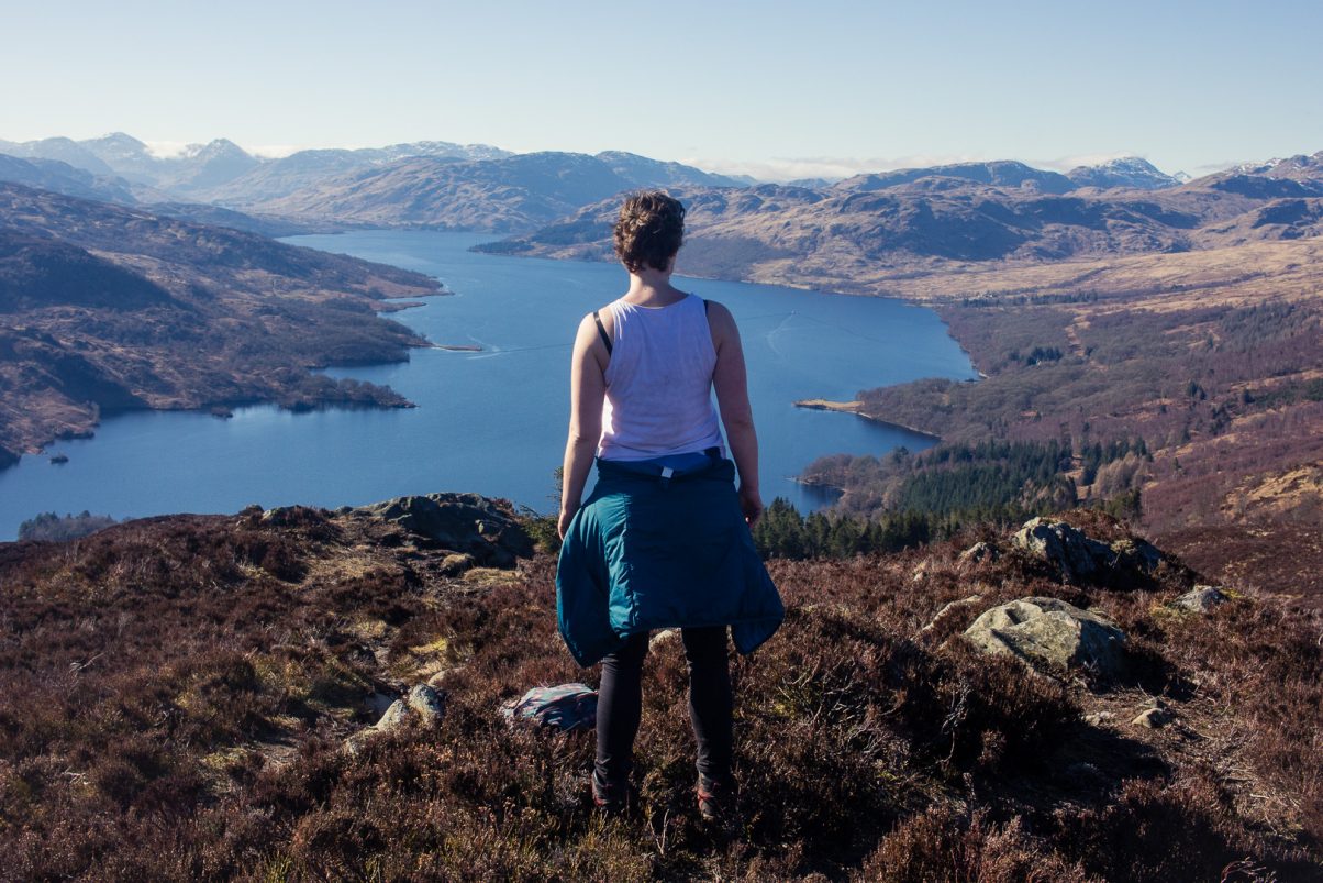
Ben A’an in Scotland
Where: Scottish Highlands
Distance: 2.25 miles
Time needed: 4 hours return
The Scottish Highlands – a landscape that inspired awe in many and a sense of adventure in even more people. But just as many people are intimidated by these rough mountains that can appear quite impenetrable, as if only true mountaineering experts can conquer them. Yet, there is a mountain hike in the Scottish Highlands for every level of experience!
Ben A’an is among the most popular hikes in the smaller hills of the Scottish Highlands. It lies in the middle of the Loch Lomond & Trossachs National Park, a beautiful forested area that stretches from the banks of Loch Lomond in the west to the outer edges of the Highlands in the east. It is surrounded by several iconic summits, like Ben Venue, Ben Ledi and Ben Lomond, but despite it’s relatively low elevation (461 m / 1512 ft) the views from the summit are breathtaking. At it’s feet lie serene mountain lochs; Loch Achray and Loch Katrine on which you can see little boats cutting straight lines through the deep-blue water.
It takes about 4 hours up and down Ben A’an, and while it is a quick climb, it is also a strenuous one. The trail starts at the car park and climbs very gently through the lower forest before it leaves the tree line behind and ascents rapidly up a steep gully. The path is well-marked and easy to navigate and you will reach the top before you know it. On the way up, stop frequently to catch a breath and enjoy the views.
You can climb Ben A’an on a day trip from Glasgow or Edinburgh, or even on your way through the Trossachs National Park higher up into the Highlands. It takes about 1.5 hours from either city by car (no public transport to start point) and there is a small car park where you can leave your vehicle for the day (£3).
Recommended by Kathi from Watch Me See
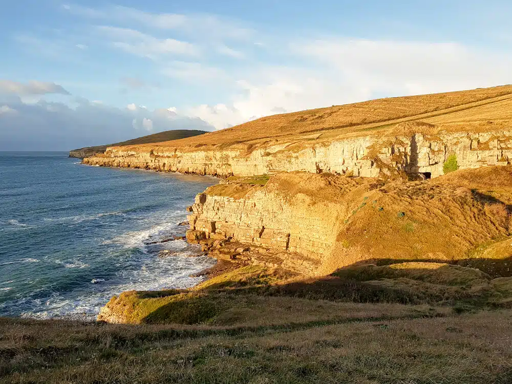
Jurassic Coast from Worth Matravers to Swanage
Where: South West English coast
Distance: 5 miles
Time needed: 2.5 hours
One of the most beautiful hikes I have ever taken was in the UK was on the Jurassic Coast, from Worth Matravers to Swanage. The Jurassic Coast stretches for almost 100 miles, from Exeter to Studland Bay, and whilst it is possible to hike it all over a few weeks, you can also just do small portions of it.
Worth Matravers to Swanage is the east end of the Jurassic Coast. The hike takes around 2.5 hours and follow the dramatic coastal path, with stunning views over the sea and the rocks. Along the way I usually stop at the Dancing Ledge, for a rest and a quick snack. The Dancing Ledge is a part of the rocks exposed to the sea, with a natural pool filled by the waves inside. On a sunny day you can swim in this pool. The rock got its name from the way the water looks like it’s dancing on it, when waves are crashing into the shore.
You can reach Worth Matravers by bus, from Swanage or from Poole. The bus drops you off less than 2 miles outside of the village and you have to walk towards the local pub to find the start of the path. The local pub, the Square and Compass, is a great little eatery with homemade meals and wonderful craft cider.
There are no places to camp on this hike.
Recommended by Joanna from The World in My Pocket

The Miner’s Track, Snowdon
Where: Snowdonia National Park, Wales
Distance: 7.5 miles return
Time needed: 4 / 6 hours
“Snowdon, in the magnificent Snowdonia National Park is, at 1085m, the highest mountain in Wales. It regularly attracts over half a million visitors a year who ascend to the summit via the Snowdon Mountain Railway or one of its eight paths. The longest, but easiest route is the Llanberis Path but when I visited I desired something a little more challenging.
I chose the Miners track for my ascent. It is the most popular track on Snowdon and for good reason. It starts with a gentle climb from the Pen-y-Pass car park, skirting both Llyn Teryn and Llyn Llydaw before rising again past abandoned mining buildings up to Glaslyn. From here things get decidedly more difficult as the path goes directly up the hill and some sections feel more like rock-climbing than hiking.
The views from the path, back down over the lakes are astonishing and it’s important to stop and turn around every now and again. The path then joins up with the Pyg Track and eventually the Llanberis Path which delivers you to the summit. The views from the Snowdon summit on a clear day are the best in the UK. You can see all the way to Ireland and Scotland.
Snowdon, in North Wales, can be accessed by car, (although the car parks are often busy) or various forms of public transport. I recommend staying in Caernarfon where you can stay within the city walls and even visit its historic castle. Every hike on Snowdon is classed as a ‘hard, strenuous walk’ which will take between 5 – 7 hrs for a round trip. Mountain conditions can change rapidly so it’s advised to have the correct gear, including several layers, waterproofs and plenty of water and snacks.”
Recommended by Tim from Tunnocks World Tour
Some Useful Hiking Resources
Our Beginner’s Guide to Hiking
The Ultimate Hiking Packing Guide
Vegan Sleeping Bag Buyer’s Guide
The Best Synthetic Insulated Jackets
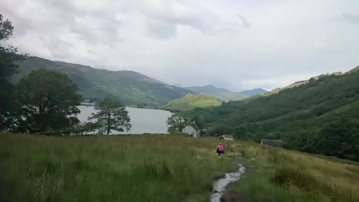
The West Highland Way
Where: Scottish Highlands
Distance: 96 miles
Time needed: 5 / 8 days but can be broken down into sections
If you want to marvel at stunning Scottish mountain landscapes and introduce yourself to multi-day trekking without getting too technical then the West Highland Way could be just the hike for you.
The 96 mile (154 km) hiking trail starts in Milngavie (make sure you get the pronunciation right and say mill-guy) just outside Glasgow and finishes all the way up North in Fort William. If you are not driving, there are train stations in both towns.
Along the way you will have the opportunity to take a dip in famed Loch Lomond, cross the vast Rannoch Moor and dig deep to get up the notoriously tough Devil’s Staircase.
The trek is usually completed in anything from four to ten days, we were glad we went for a sensible length of seven days.
If you prefer hiking in complete solitude, it is not likely for you. The route is very popular but it does mean you get good banter with other walkers and plenty of accommodation options.
Some of my key tips:
- Make sure you come stocked up with good insect repellent, the Scottish Midge can be utterly relentless.
- Comfy, broken in boots are essential. Blisters meant some of our fellow walkers were unable to finish. Make sure you also have Vaseline, good socks and Compeed Plasters.
- Book your accommodation well in advance, there are plenty of great campsites and hostels along the route.
- Knowing the unpredictable nature of Scottish weather and to have access to more accommodation options I would recommend avoiding walking the route in Winter.
Planning a trip to Scotland? This Scotland packing list has some great advice!
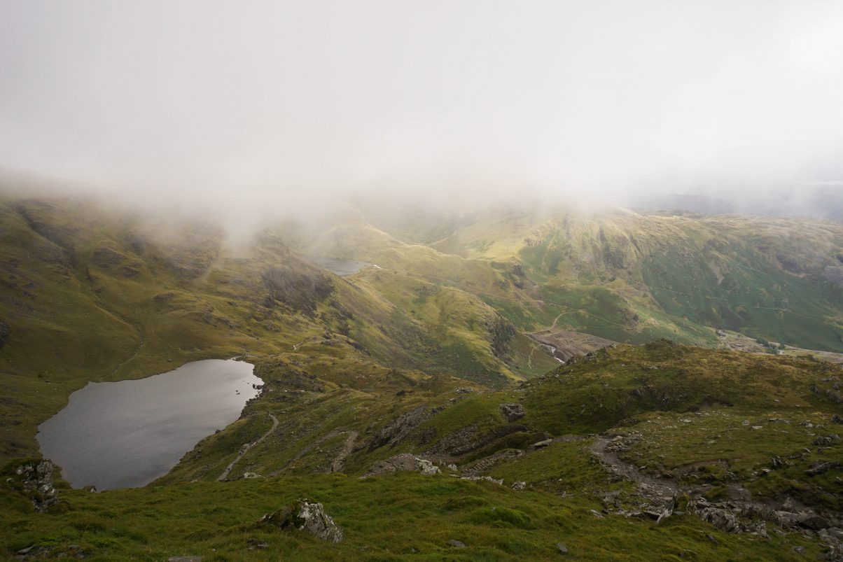
The Old Man of Coniston
Where: The Lake District, UK
Distance: 7.7 miles
Time needed: 3 / 4 hours
The Old Man of Coniston is one of my favourite hikes in the UK. It’s a popular day hike in the Lake District, but don’t let its popularity put you off. This hike has it all – lots of varied views, enough differing terrains to keep things interesting and a tougher stretch that will put you through your paces right before the end.
There are several paths leading to the top of Coniston. We started our hike in Coniston Village and took the tourist trail up the fell. The path starts by meandering along a stream, before a short pull up to an abandoned tin mine. This is where the real fun starts – you climb up to the beautiful Low Water lake. Not sure why it’s called that as it’s up at 550m. I’d advise you to take a little break here, because the last section is steep and unrelenting – the good news is it’s pretty short. Of course, the last time I hiked to the top, it was shrouded in thick cloud… nevermind because the journey down is just as fun. Instead of going back the way you came, I’d suggest taking the longer alternative route down via Goat Water. It’s a slower route but the scenery is beautiful and much nicer than just retracing your steps.
If you stay in Coniston, you can set off before the crowds do so the path is quiet, but it’s fun even when it’s busy.
The whole hike is around 7.7 miles and it takes about 3-4 hours to do it if you’re taking your time. you don’t need any technical equipment but I would advise bringing an OS Map as the cloud can come in quickly and away from the tourist path, there are a few unclear junctions. Wear sturdy footwear and bring layers – but most of all, enjoy!
Recommended by Julianna from The Discoveries Of.
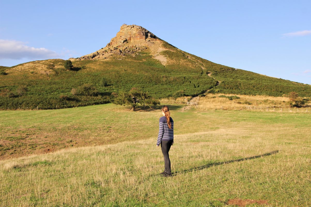
Roseberry Topping
Where: North Yorkshire Moors National Park
Distance: 1 miles
Time needed: 30 minutes
Roseberry Topping is a fantastic hike in the North Yorkshire Moors National Park. Whilst Roseberry Topping is by no means the biggest peak in the area, this hike is one of the UK’s finest due to its fascinating history as well as iconic shape.
Captain James Cook was a British explorer who sailed as far as New Zealand. As a boy, he lived close to Roseberry Topping. It is said that he would hike Roseberry whenever he could leave his father’s farm. These early hikes influenced his wanderlust for his later explorations. Indeed, it is impossible to forget his association with Roseberry Topping as the Captain Cook monument stands proudly on the neighbouring moor and can be seen from the summit.
Roseberry Topping itself is also interesting from a geography perspective. The small mountain has a conical shape, resembling the shape of whipped cream on an ice cream sundae. It looks like something Dr Seuz might have imagined and drawn in his comics. Some locals even nickname the peak ‘the little Matterhorn’ due to its similarities with its Swiss cousin.
The hike itself takes around half an hour from the car park to the summit making it one of the best day hikes in England, perfect for all abilities. The hill is great to climb all year round yet once you leave the woods the path is rather wild, meaning it is not recommended to undertake in wet weather or icy conditions. Yet on a dry, sunny day the Roseberry Topping hike is one of the best in the UK.
Recommended by Anna from My Travel Scrapbook

Stac Pollaidh
Where: Ullapool, Scottish Highlands
Distance: 3 miles
Time needed: 2 hours
One of the easiest hikes to do on the North Coast 500 in the Scottish Highlands is the Stac Pollaidh near Ullapool. The hike itself is under 3 miles and takes a mere two hours to complete but you might lose another hour taking in the views of Assynt and the Summer Isles from the top!
There is a path which takes you from the car park (best reached by car) to the summit. Towards the top is a little rocky but nothing too fierce underfoot. This is an all-season route and a perfect hiking for beginners, just remember the right equipment during winter.
The closest town Ullapool is a hotbed for live Scottish music (look out for my friend, Kim Richards) and art. There is a variety of accommodation from a hostel dorm bed to a hotel room. There’s even a campsite. Ferries sail from Ullapool to the Isle of Lewis too.
Recommended by Gemma from Two Scots Abroad
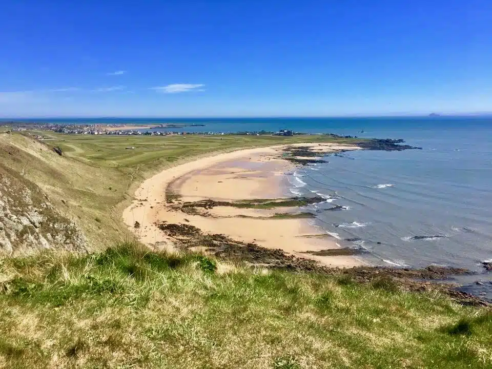
The Fife Coastal Path
Where: Fife, East Coast Scotland
Distance: 117 miles
Time need: 7 / 10 days but can be broken down into sections
The Fife Coastal Path curves the coastline in the Kindgom of Fife, on the east coast of Scotland. The whole route is 117 miles long and passes through cute colourful fishing villages, past castle ruins and along white sand beaches and dramatic sea cliffs.
Beginning at the Kincardine Bridge which crosses the Firth of Forth, passing the famous bright red Forth Rail Bridge the path ends just after the Tay Bridge in Newburgh. The hiking path is well marked and although not technically difficult some of the path is narrow and can get slippery when it’s been raining.
Some sections take you high up along the cliff edges and give absolutely gorgeous views over the water. The beaches along this route are stunning and the fishing villages, in the East Neuk, are picture perfect and ideal to stop off for a bite to eat. There is lovely accommodation in the towns and villages and delicious restaurants serving locally produced food.
I would recommend walking the Fife Coastal Path over a week and the spring is the perfect time to do it as the path will be quieter won’t be too hot or cold. This is a fantastic long walk and the perfect way to spend a week.
Recommended by Ella from Funky Ellas Travel
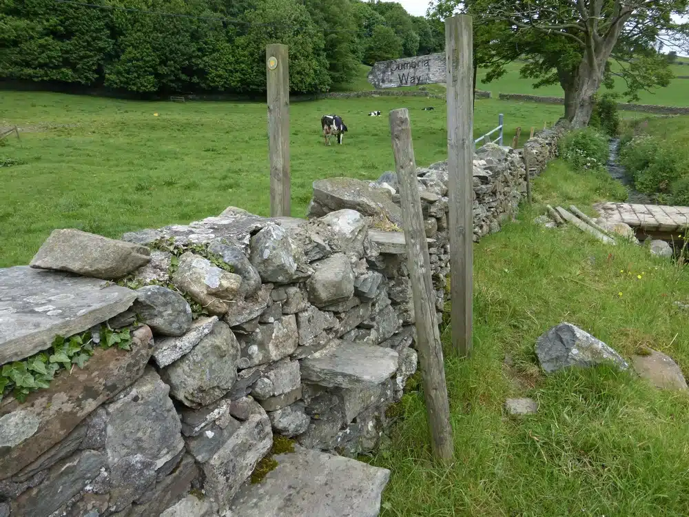
The Cumbria Way
Where: The Lake Disctrict
Distance: 84 miles
Time needed: 5 / 7 days but can be broken into sections
The Cumbria Way is a well known long distance hike in the Lake District of western England. The full hike leads from Ulverston in the South through Keswick to Carlisle in the north in about 84 miles over 5 – 7 days.
The stretch from Ulverston to Keswick lasts roughly 4 days and is a lovely walk through different landscapes with plenty of challenge. If you are a reasonably fit hiker or have enough stubbornness to make up for any lake of athleticism, then it is great. Every landscape you can imagine is present in this beautiful area. Pubs at the end of each day’s walk offer soft beds and a tasty pint to reward the day’s walk.
Ulverston and Carlisle are served by train and Keswick has a bus station. The best way to do this walk is organise the string of Bed and Breakfasts and have your bags transferred along. There are companies that provide the bag service, reserve the hotels, and give a guidebook for the walk. This leaves you with a day pack for your water, guidebook, and lunch which makes the walk more pleasant. My dad and I went in June which was a great time. Plants were green, the sheep were fluffy, and the ground was dry. It was warm enough to not feel cold, but cloudy (yay English weather) enough not to be sweltering.
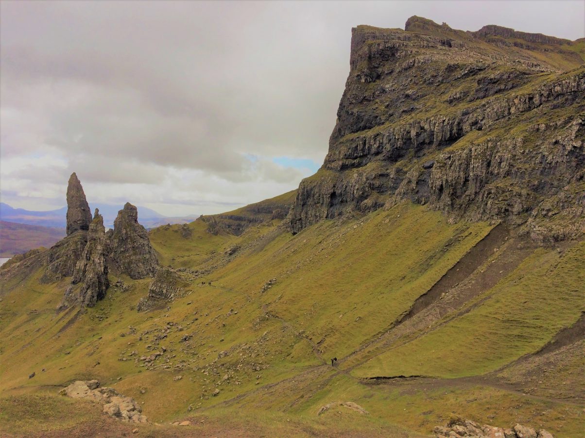
The Old Man of Storr
Where: Isle of Skye, Scotland
Distance: 3 miles
Time needed: 1.5 hours
The Old Man of Storr is one of the best hikes that the Isle of Skye in Scotland has to offer. This is a large spiky rock formation on top of a rocky hill that is a part of the Trotternish Ridge with views over the Sound of Raasay.
You know you’ve arrived at the car park for the hike when you see cars parking along the highway. This is one of Skye’s most popular attractions so be prepared to be with a few other hikers. Try to do the hike either in the early morning or later in the day as the majority of hikers go between the hours of 10am and 3pm.
Depending on your fitness level, it should only take 1.5 – 2 hours, I did the hike twice. Once was to go up and explore the Old Man and the other was to go up to the right and explore the Ridge. Both have spectacular views and would recommend exploring both sides. Now remember, this is Scotland. It will probably rain and the trail will become muddy. Just take your time and be careful as you go up the steep sections.
There are no amenities and no food around so just be prepared and take a snack so you can have a nibble while enjoy the perfect views of Skye.
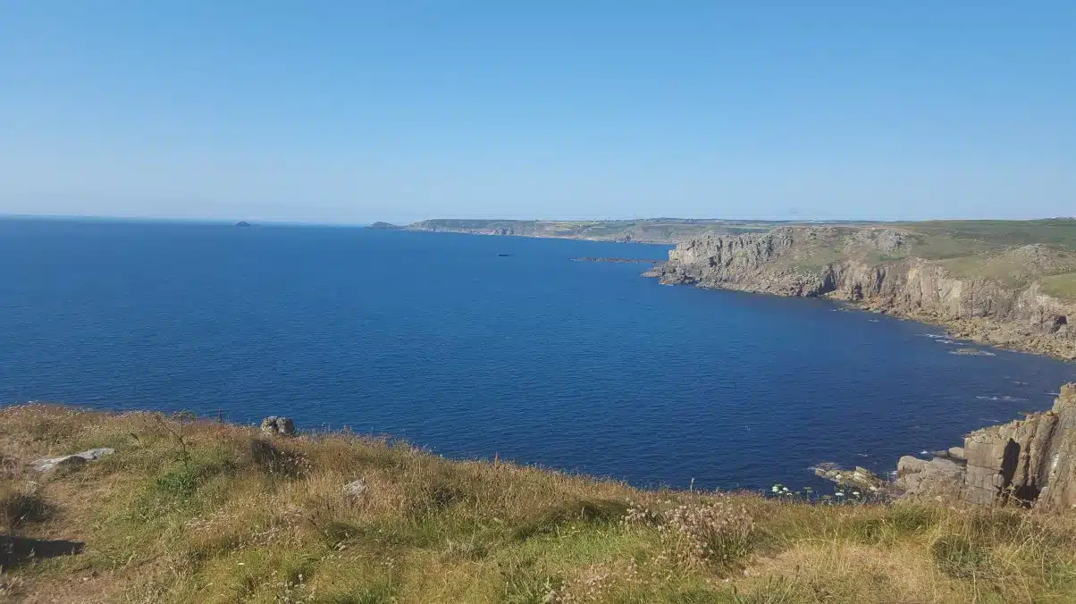
Land’s End to Sennen Cove
Where: Cornwall, South West England
Distance: 3.3 miles
Time needed: 1.5 / 2.5 hours
If you’re in the South West of England, the Land’s end to Sennen Cove walk is one of Cornwall’s most beautiful.
How could it not be when you’re looking out over the crashing blue waves, skirting an incredibly atmospheric coastline. Land’s End has all the romance and soul of a once-remote area that is still the furthest west you can go in the entire mainland UK.
You’re best off going in the spring or autumn. Summer can also be fantastic, but be prepared for some positively uncharacteristic British heat!
The hike is only around three miles, perfect for those who aren’t hardcore proficient hikers. And as a bonus, Land’s End is home to a clifftop pub (the most westerly one in the UK), a high end restaurant which also includes a hotel and even a family theme park. That means you’ll have all the amenities you need, with a chance to lick an ice cream, grab a cream tea and more.
Recommended by Dani from Live in 10 Countries
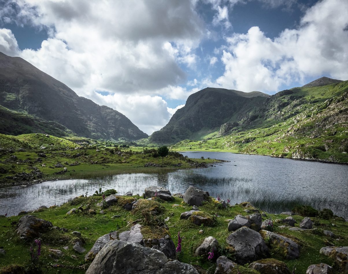
Gap of Dunloe
Where: Country Kerry, Ireland
Distance: 9 miles
Time needed: 4 / 5 hours return
The Gap of Dunloe is a stunning, narrow mountain passageway in the County Kerry, Ireland. The road stretches from the MacGillycuddy’s Reeks (in the west) to Purple Mountain (in the east).
The road is about 7 miles long and is best enjoyed on foot. The hike is not considered strenuous and you can make it as long or as short as you like (as you can enjoy a beautiful view from an angle at any point in your journey), but you will not want to rush yourself. Allow yourself a minimum of 4-5 hours to hike round trip, which will allow for several stops.
During your hike you will enjoy the view of rolling, green hills and five relaxing lakes. You’ll find yourself in the company of friendly sheep and you will want to explore the authentic cottages along the way.
The Gap of Dunloe is best enjoyed during the summer months and travelers will likely want to stay in nearby Killarney. After your hike, enjoy lunch at Kate Kearney’s Cottage, a 150 year old, family-run restaurant (located at the entrance of the gap).
Recommended by Leah from An Adventure Is Calling
18 of the Very Best Hikes in the UK You Need to Explore This Year
Have you done any of these hikes or have any other favourite hikes in the UK? Tell us in the comments below!
Keep exploring…
Our Guide to the Ben Nevis Walk in Scotland, UK
Peak District Walks: A Complete Guide to this Stunning UK National Park


