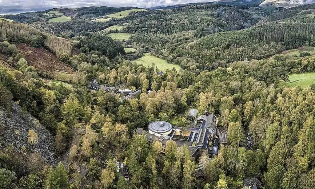
If you’re going hiking in France you need to check out these trails!
You’re not likely to come across many other countries with such stunning, well-marked and accessible trails as France. Everything from 2 hour hikes with panoramic views of the Alps, traverses across glaciers, trails along mountainous lakes and clifftop paths taking you to ancient castles – France has it all.
But, what separates France from other countries is how easy the hiking is. Don’t get me wrong, you’ll find some of the hardest hikes in the world, but the hiking infrastructure is so well established it’s almost harder not to end up with your boots on, half way up a mountain.
This all means that it’s crazy easy to get your nature, adrenaline or relaxation fix so don’t be surprised if you cancel all your other travel plans to spend more time in the outdoors.
In this article you’ll 11 of the best hiking trails France has to offer, along with local accommodation and tips so you can plan your next adventure!
11 Epic Trails that Will Make You Want to Go Hiking in France
Tour du Mont Blanc (TMB)
- Location: Mont Blanc is located in France but the hike takes you through Italy, France and Switzerland
- Starting/finishing point: A circular route with most hikers beginning and ending their trek in Les Houches, France, an easy bus transfer from the popular ski town of Chamonix.
- Recommended time needed: Many hikers average around 11 days to complete the TMB, as 170 km (105 mi) must be covered with extensive daily elevation gain and loss.
- Difficulty: Hard
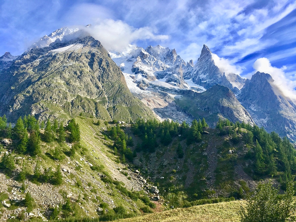
If you’re hiking in France Tour du Mont Blanc should be high up on your list. This is a physically demanding route, with approximately 9,000 meters of cumulative elevation gain and loss throughout the duration of the hike. For this reason, it is recommended that hikers be in good physical shape prior to the trek. The mental difficulty, however, is quite low, as the trail is well marked and quite busy throughout the hiking season. It is also possible to stop at the numerous gîtes, or refuges, along the way for a snack or coffee break mid-day.
The TMB is one of the most popular long-distance treks in Europe and the world for good reason – the trail is accessible from multiple locations, traverses through three different countries, and covers stunning landscapes, including high alpine environments to flower-hewn meadows along soft-flowing streams.
Avoid hiking during the Ultra-Trail du Mont Blanc at the end of August, as the crowds can be heavier than usual. Before going into the high mountains, keep a watchful eye on the weather forecast, as storms roll into the mountains quickly and without warning.
Recommended by Christa from Expedition Wildlife
Find accommodation for hiking Tour du Mont Blanc
The GR20 Hiking Trail
- Location: Corsica, France
- Starting/finishing point: Most usual way is from north (Calenzana) to south (Conca) but can be done in the opposite
- Recommended time needed: Normal duration is 16 days but for good hikers it can be done in 10 to 12 days
- Difficulty: Very difficult (but really worth it!)
The GR20 is very well known among hikers for being one of the most difficult treks, but also the most beautiful, in Europe (and I do not just say that because I’m French!).
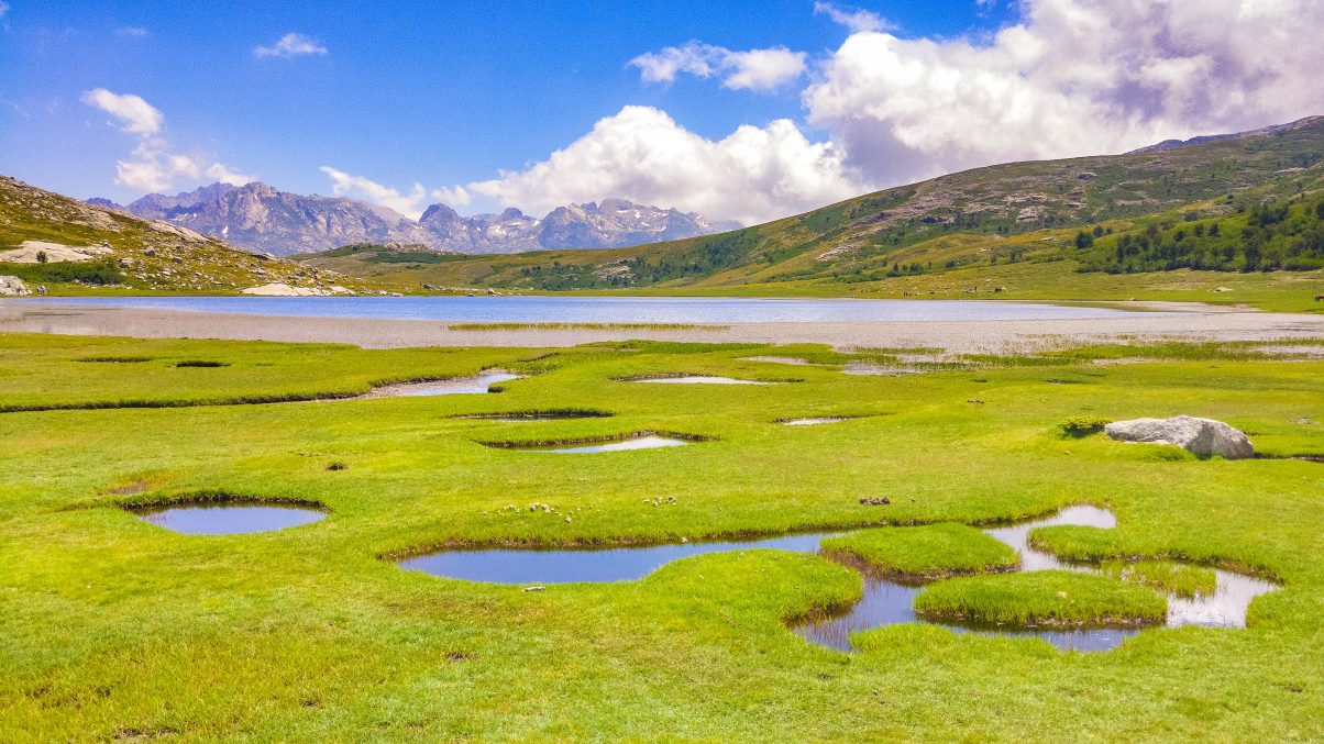
The trail crosses Corsica island from north to south with 180km distance and more than 10,000 metres of positive elevation gain through varied and splendid landscapes (red mountains, mountain lakes, natural pools, pozzines …). The north is very technical with some air passages and acrobatics – better not to be dizzy. The southern stages, although less technical, are no less difficult, especially the alpine variants on the ridges.
Given its difficulty, this trek is primarily for experienced hikers, athletes and the well prepared, but once on the trail, the landscapes are so beautiful that they are worth all the efforts.
Having already several treks to my credit, I recommend the GR20 to anyone wanting to discover the adventurous side to hiking in France. On top of raging day-after-day landscapes across this beautiful island the GR20 also has wonderful human encounters.
The paths across a protected regional park: the bivouac, are forbidden to cross except near the refuges and sheepfolds where it is also possible to sleep.
Recommended by Sarah from Vents et Voyages
Find accommodation for the GR20 hiking trail

Colorado Provenzal Location: Luberon, Southern France
- Starting/finishing point: Paid parking outside the park near Rustrel, 10 km from the lovely village of Roussillon
- Recommended time needed: 5 km, 2-3 hours
- Difficulty: Easy
In the region of the Luberon you can find one of the natural highlights of Provence: the Provenzal Colorado. In the area where ochre was previously extracted from the ground, a very colourful landscape has formed as a result. Ochre is a natural pigment that contains different quantities of iron oxide, which results in different colours from red to orange. When you walk in this area some of the landscapes really remind you of the famous landscape scenery in Colorado. You’ll find all kinds of rock formations with white, red and orange colours – it’s simply stunning!
The hiking trail is circular and you can find different kinds of spaces, such as the Sahara, the Chimney of the Fairies or the White Desert. All these spaces will amaze you, especially if you love taking pictures of natural themes. The trail is open during the whole year, except for January. Make sure you take good hiking shoes, since the rocks can be slippery, especially after rain.
Recommended by Gabor from Surfing the Planet
Find accommodation for hiking in the Colorado Provenzel region
Cirque du Fer-à-Cheval
- Location: Sixt-Fer-à-Cheval, on the French-Swiss border, 30km from Chamonix
- Starting/finishing point: Parking lot of Cirque du Fer-à-Cheval in Sixt-Fer-à-Cheval (paid parking)
- Recommended time needed: 3-4 hours
- Difficulty: Medium
If you tried counting the waterfalls on a map of the village Sixt-Fer-à-Cheval and you might get lost before even starting your hike!
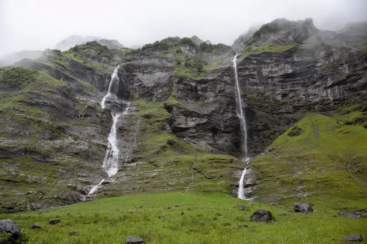
The gorgeous cliffs of the horseshoe-shaped (fer à cheval) valley shimmer with thundering waterfalls. The valley itself hosts numerous sheep and hikers from early May until early November but hiking outside of this time isn’t advised due to extreme avalanche danger.
An easier 60-minute hike tours visitors around the horseshoe, but if you are interested in a little more adventure try hiking the trail to the End of the World (le Bout du Monde), a 4-hour, well-marked hike to the far end of the valley. You don’t need to be an alpinist to conquer this hike, but do wear hiking boots!
The trail starts out as a large path through the trees, but once you leave the trees behind, the trail becomes narrow and the cliffs are steep. The hike starts at the left side of the valley. Leaving the fields of ponies behind, you enter the national nature reserve of Sixt-Passy.
Snow-capped mountains and impressive peaks like the Corne du Chamois (2560 m) and the Mont Ruan (3040 m) rise high above you and, if the physical effort doesn’t do it, the views will take your breath away.
Before starting the more challenging part of the hike, rest your feet in one of the comfortable chairs of the Chalet du Boret, before walking on to the End of the World. The reward for climbing the 270 meters to the end of the valley are some of the most spectacular views of the French Alps you can find from a day hike.
The way back to the parking lot covers the right side of the valley where, once again, you will be surprised by magnificent waterfalls, remnants of avalanches, alpine meadows, and adorable mountain sheep.
Recommended by Hannah from Surviving Minus 30
Find accommodation for hiking Cirque du Fer-à-Cheval
Mer de Glace from Chamonix
- Location: Chamonix-Mont-Blanc
- Starting/finishing point: Chamonix, France
- Recommended time needed: 4-5 hours, plus time to enjoy the views of the glacier
- Difficulty: Medium
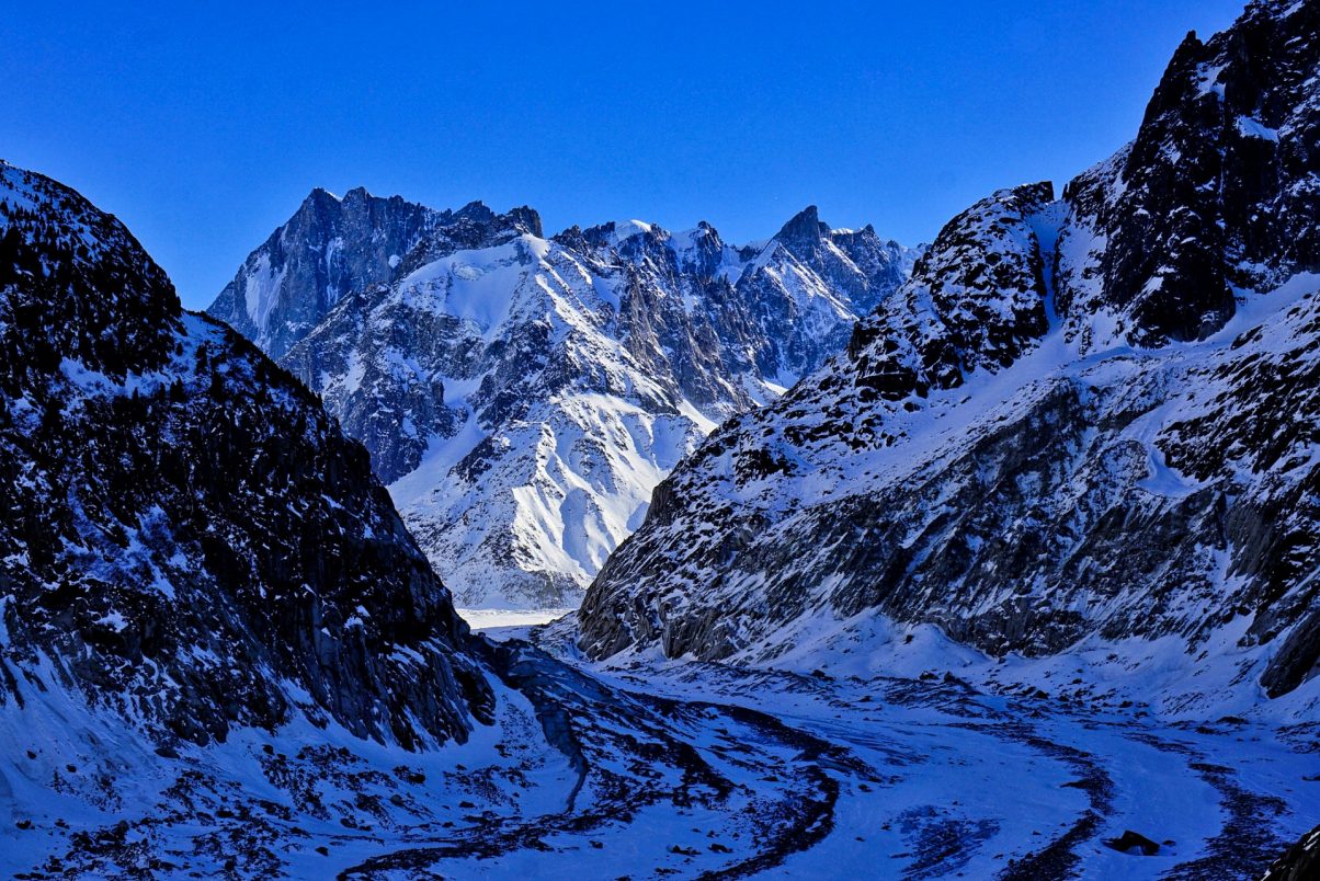
Mer de Glace became very (in)famous as the poster child of climate change. The way the “Sea of Ice” has been reducing over the last few decades is worrisome, but still is a spectacular sight.
There’s a very scenic train from Chamonix that takes you to the glacier, but if you’re in the area during summer, it’s much more fulfilling to hike there. You’ll face an altitude gain of about 900 meters in a 14 km loop circuit that will take you 4-5 hours to complete. You also have the option of taking the train up and hiking down.
This is a summer hike that can be done from June to August. If you want to try in autumn or spring, most likely you’ll need crampons since still there will be big patches of snow. And, as the hike is steep, it can be dangerous if you’re not experienced in this kind of terrain.
The path goes inside a beautiful forest, where it’s not uncommon to run into deer. At the end you’ll be rewarded with France’s largest glacier, stunning views of the Grandes Jorasses massif in the background and Les Drus on the side. And, after descending 500 steps from Montenvers, you’ll be able to get inside the glacier at grotte de glace, the ‘ice cave’!
*Tip* It’s recommended to take your own snacks and water to avoid the crowds and the steep prices!
Recommended by Coni from Experiencing the Globe
Find accommodation for hiking in Chamonix
Some Useful Hiking Resources
Domancy Hiking Trail
- Location: Domancy, France
- Starting/finishing point: Near Lac Vert, Domancy
- Recommended time needed: 4-5 hours
- Difficulty: Moderate
France is an incredible country for hiking! Regardless of the region, there’s a bipedal adventure to be had in its great and diverse outdoors.
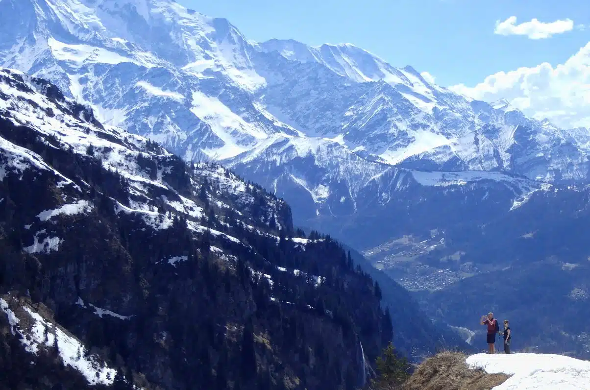
Of all the places that I was lucky enough to explore, Domancy, in the Haute-Savoie, was undoubtedly one of my favourites. It offers some of the most spectacular hiking I ever found in the country. It’s just down the road from the popular ski resort of Chamonix, though they’re worlds apart in terms of size, glitz and glamour. Domancy is far smaller and quieter, but shares all of the same beauty of the area around Mont Blanc.
Much to my frustration, I can’t remember the exact details of the hikes I did there in terms of names and precise starting points! However, that shouldn’t matter too much. In the months outside winter, hikes litter this landscape wherever you go.
One that stands out in my mind was near the stunning emerald waters of Lac Vert. This little lake is set high up on the opposite side of the valley from Domancy. Cross over from the town, and venture (by car) up the long and winding road up to the side of the mountain, headed towards Praz Coutant. It was in this particular area that I can highly recommend you go for a hike!
Expect the hiking to be fairly strenuous here, with some reasonable uphill stretches that’ll get the legs pumping. Likewise, be prepared for snow outside of summer. The winter season will make this off-limits to ordinary hikers (get your ski boots on instead), and the snows can even persist into spring time too. We had to turn back due to a snow block on the path. Otherwise, the paths are well maintained and take you through some of the most glorious scenery in Europe. Enjoy!
Recommended by Danny from What’s Danny Doing?
Find accommodation hiking in Domancy region
GR10 Hiking Trail (Pyrenean Way)
- Location: The French Pyrenees
- Starting/finishing point: Hendaye to Banyuls-sur-Mer
- Recommended time needed: Two months, window between mid-June and end of September
- Difficulty: Hard stuff
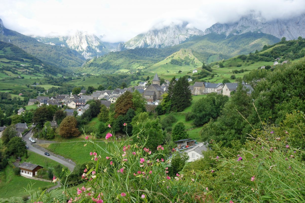
At 900km long and with 50km of climbing, the Pyrenean Way is not going to be to everyone’s taste but for shear variety, this well-marked path takes the biscuit. It meanders through the bucolic Basque country with its half-timbered farmhouses and then climbs up to St-Jean-Pied-de-Port where it crosses the Way of St James. Continuing ever higher through Iraty, one of the biggest beech forests in Europe, it comes out into the open, a mere scratch on the rocky flanks of the peaks. Here it reaches its highest point at 2734m above sea level. For those who like a little challenge, the summit of Petit Vignemale is a mere hour away.
Continuing eastwards, forest reappears in Ariège, though the path is often above the treeline, affording trekkers silver-lined vistas of the cloud-sea, washing from side to side in the valleys below. Finally, the path tumbles between cork oaks and cacti back to sea-level and dives towards the Mediterranean.
But it isn’t just about the views. There are bears and wolves here, though walkers are unlikely to see any. There is a slightly better chance of meeting an ibex. And the certainty of deer, marmots and Pyrenean chamois. Just as interesting are the encounters with the locals always willing to explain how traditional farming works. And one of the great things about walking the Pyrenean Way is the camaraderie engendered by the shared challenge of walking across a continent.
If you do want to go hiking in France but feel that walking for two months would be too big a bite to chew, there are several access points and many walkers plan to complete the route over four summers.
Recommended by Stephen from Pyrenean Way
Find accommodation for hiking the GR10

Camino Francés, Stage 1
- Location: Southern France/Northern Spain
- Starting/finishing point: St. Jean Pied de Port / Roncesvalles
- Recommended time needed: 7 to 9 hours
- Difficulty: Medium
The Camino de Santiago is a medieval pilgrimage trail that leads to Santiago de Compostela in the northwest corner of Spain, where the remains of St. James are kept inside the Cathedral. In medieval times, pilgrims began their journey simply by walking out their front door, so there are many different versions of the Camino de Santiago that start from different points all over Europe.
However, the most famous route, and the one that most people are referring to when they talk about walking the Camino, is the Camino Francés, or the French Way. While there are many possible starting points in France, the most popular is St. Jean Pied de Port, a picturesque village in the Pyrenees.
From here, pilgrims cross the Pyrenees mountains, arriving at the monastery of Roncesvalles at the end of a long but spectacular hike. For those walking all the way to Santiago, this is just the first day of an 800-kilometer journey that will take more than a month to complete.
But of course, you are welcome to do only the first stage and end your hike in Roncesvalles. Just beware that the Camino has a way of enchanting people, so you may very well find yourself returning one day to complete it!
Along the way, there is a small hotel called the Auberge Orisson that offers meals, but you should still bring plenty of water and snacks. Vegetarians and especially vegans on the Camino de Santiago should be prepared to self-cater.
While there is an albergue de peregrinos (pilgrims’ hostel) at the monastery in Roncesvalles, you will only be allowed to stay here if you have a credencial, or a “pilgrim’s passport” as it’s often called in English. A couple of hotels and posadas nearby offer private rooms. Otherwise, check bus schedules carefully to make sure you will be able to catch the last bus back to St. Jean.
Recommended by Wendy from Nomadic Vegan
Find accommodation for hiking the Camino Francés
The Cathar Way
- Location: Occitanie
- Starting/finishing point: Start near Toulouse, finish near Port-la-Nouvelle
- Recommended time needed: 2 weeks
- Difficulty: Moderate
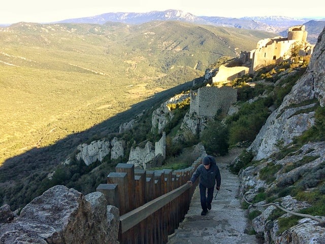
This well-marked but never too busy trail begins in Foix, south of Toulouse, and traverses the ancient and mystical land of Occitanie to bring the walker to the sea at Port-la-Nouvelle. What better way to revive weary feet than a dip in the Med? Landscapes vary considerably as the lush forests and mountain meadows of the first half of the walk give way to more arid and rocky terrain, and finally to the briny breezy plains of the littoral. It is a route steeped in both history and legend.
The Cathars were brutally persecuted for their beliefs in Medieval times and fled to hilltop castles. Of these, three stand out: Montsegur, Peyrepetuse and Queribus, impossibly perched on dizzying precipices, and commanding stunning views over the local area and towards the high tops of the Pyrenees. As if that’s not enough, there are also rumours that the Holy Grail may have ended up in this part of the world, and anyone who has read the Da Vinci Code will spot some familiar places en route.
More recently in 2012, the prominent and spectacular Pic de Bugarach became central to an ‘end of the world’ event as thousands of people headed for the mountains’ slopes believing that an alien spaceship was going to save them!
Make sure to check out some of the local markets along the way too. Esperaza on a Sunday morning in particular is a special experience, full of life, music and characters. It is also full of vegan, vegetarian and gluten-free delights to feed a hungry hiker. And of course, as you approach the Mediterranean you enter the Corbieres, famous for its rich, herb scented wines.
Overall the walk is of moderate difficulty and is suitable for all times of year, though bear in mind that it can get very hot in summer, and also surprisingly cold in the winter (especially at night).
Both ends of the trail are accessible by main-line train, and there are a number of international airports nearby including Carcassonne and Beziers.
Recommended by Chester Bingley from Native Knowledge Tours
Find accommodation for hiking the Cathar Way
The Friedrich Nietzsche Trail
- Location: Southern France, close to Nice
- Starting/finishing point: Starting from Cap-d’ail Rail Station and finishing at the village of Eze
- Recommended time needed: 30-60 minutes
- Difficulty: Easy
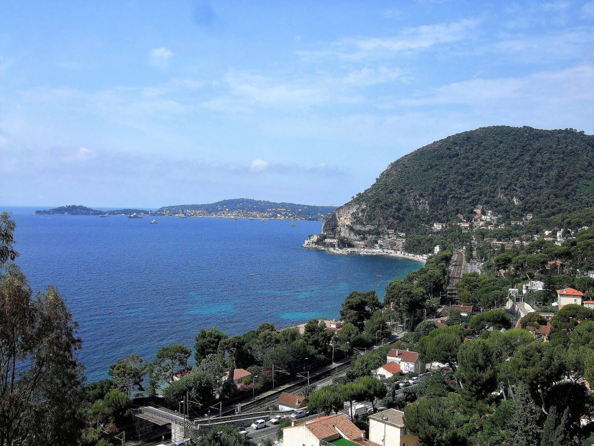
The Friedrich Nietzsche trail is located in southern France, a perfect day trip from Nice. Hiking the Friedrich Nietzsche will take you from the Cap-d’ail Rail Station (follow the signs) to the top of the mountain where you will finish at the village of Eze. This is a fairly easy hike that takes about 30 minutes to an hour to complete because while it is short in distance, the trail can be quite steep. If you want to hike this trail with ease, take a look at these pro tips!
As you climb the Friedrich Nietzsche, you will have the opportunity to pause at bends where you can look out over the glistening Mediterranean Sea and all along the coastline. Just before you reach the top of the trail, you can choose to stop at the Fragonard Perfumery for a tour and to buy their unique scents. Afterwards, it is only another few meters before you reach the entrance to Eze. This quiet mountain town is a lovely location for a rejuvenating lunch and to go shopping! Make sure to peruse the unique hand-crafted shops before you leave.
When you’re ready you can head back by traversing back down the trail. Once again at Cap-d’ail Rail Station you can return to your original destination, sight-see in Nice, or continue to Monaco.
Recommended by Chelsey from The Ninja Gypsy
Find accommodation for hiking the Friedrich Nietzsche trail
And our hiking recommendation from Veggie Vagabonds!
Le Môle
- Location: 30 km southeast of Geneva
- Distance: 9 km
- Time Needed: 2-3 hours
- Difficulty: Easy
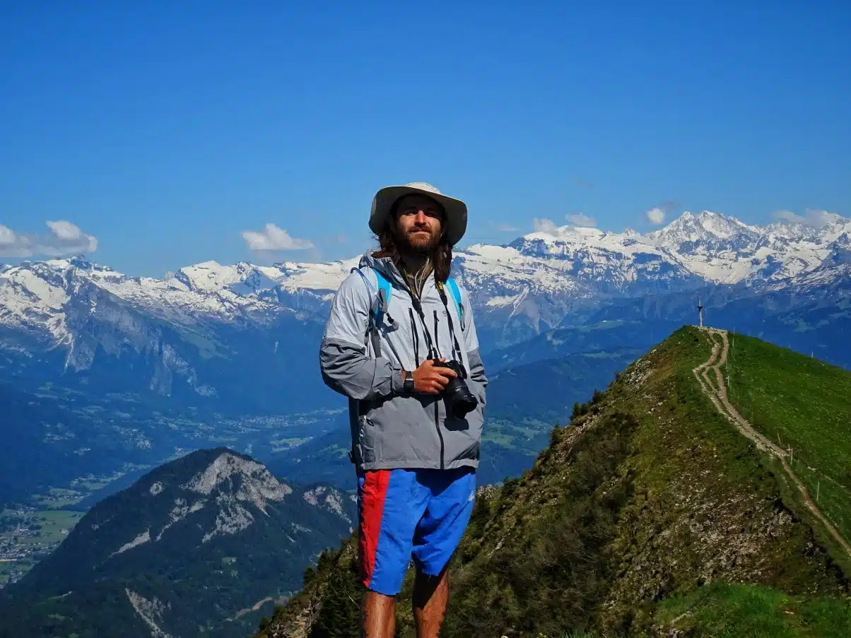
We just had to include this one – it’s almost cheating having such incredible panoramic views of the Alps from such a short hike – but hiking in France doesn’t have to be hard work!
This almost perfectly triangular peak is easily accessible from Geneva or coming from other areas of the Alps. You’ll find a car park at the base of the mountain but no nearby amenities so stock up before you come. For regular hikers it’s best to tackle Le Môle in the spring, summer or autumn, winter hiking in France is a whole other world!
The hike itself is short but sweet, the ascent will only take a few hours, though you’ll see people running and even cycling up it. Around two thirds of the way up you reach Le Petit Môle, a beautiful grassy peak where you’ll find stunning views of Mt. Saleve, Geneva, Lac Leman and the Jura Mountains.
Keep following the well-marked trail further up and you’ll reach the peak, standing at 1,863m. From here you have an absolutely breathtaking vista of the French and Swiss Alps, Mont Blanc and the Bornes Massif – you really are spoilt!
To find out more about this incredible hiking trail you can take a peep at our Le Môle hiking guide.
Find accommodation for hiking Le Môle

Keep exploring…

